by Local History Librarian David
Bexley Day, which falls on August 10, 2022, marks the 114th anniversary of the first council meeting of the Village of Bexley. This year Bexley Public Library, in partnership with the Bexley Historical Society, is celebrating Bexley Day with the program, Mapping Bexley From Wilderness to Village.
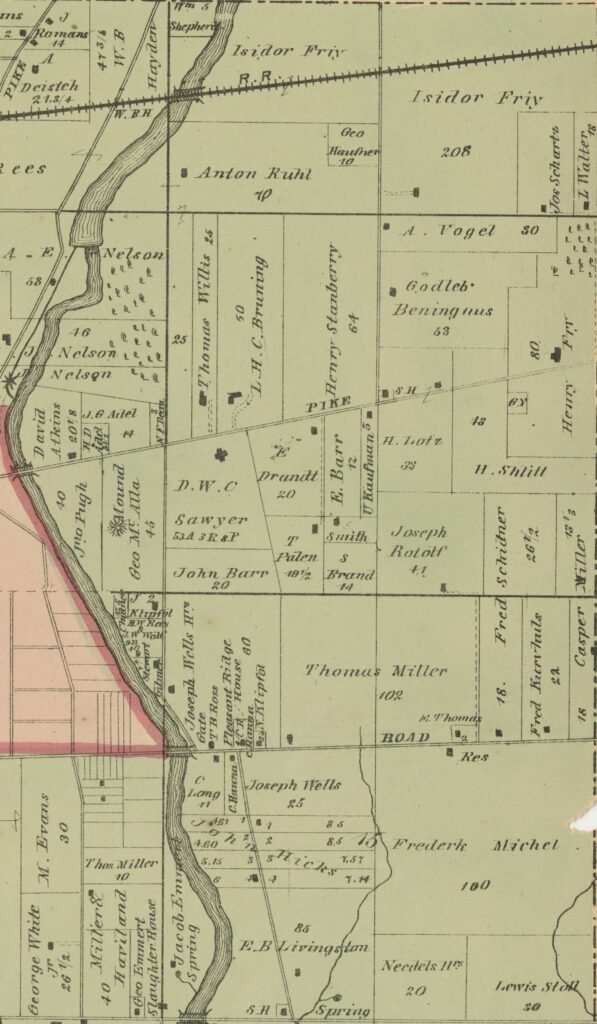
Using maps dating back to 1799, Bexley Public Library Local History Librarian David Distelhorst, will demonstrate how the elements of modern day Bexley– its boundaries, roads, neighborhoods– and more, have their roots in the nineteenth century and earlier.
Once part of Montgomery Township, the eastern boundary of Bexley, Gould Road, runs along the eastern boundary of the township, which was platted in 1799 as Township Five of Range 22 of the Refugee Tract.
The Refugee Tract, land set aside by the Congress of the United States to settle the claims of Canadians who lost their property during the Revolutionary War as result of their support of the Colonies, was divided into half sections in 1801. Four whole half sections and portions of an additional three half sections make up modern day Bexley, and the center boundary line separating the four runs north and south along Cassady Avenue.
Viewing historic maps reveals how north, central, and south Bexley were carved out in the early 1800s when the first roads crossed the landscape. First was the laying of Broad Street, then called the Columbus and Granville Road, that would later separate north and central Bexley. Then in 1833, the National Road reached Columbus, which today separates central and south Bexley.
On August 10 at 7 PM at Bexley Public Library, find out why Pleasant Ridge Avenue isn’t the first of its name and discover through historic maps how the Bexley we know today was influenced by actions taken more than a century ago. For more information and to register for the program, visit www.bexleylibrary.org/local-history.